Showing posts with label maps. Show all posts

Sunday, April 2, 2017

Space Gaming - 2d vs 3d maps

A discussion group on Facebook that talks about Traveller related items has been talking about 3d mapping vs 2d mapping.  I am a big fan of Classic Traveller (1977) and its derivative games.  Those include MegaTraveller, T4, T20, T5 and Mongoose Traveller.  One of the things about them, however, is that going back to the original, they render star maps in a 2d fashion, typically on a hex grid.  Let me say, that I am a big fan of the 2d representation, because it is not true (form a Physics sense) but it does represent a presentation of game/setting information in an intuitive and extremely useful format. What could be better?

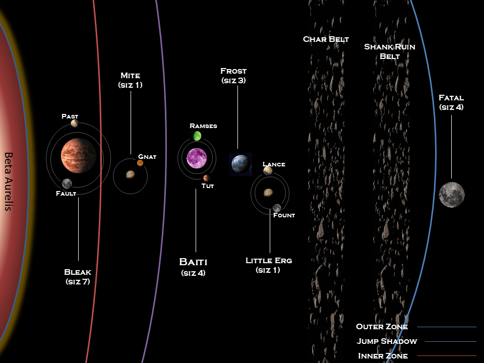
On a Traveller map, the first thing you will notice is hexagons, some with "world systems" marked in it.  Each hexagon represents a parsec (roughly 3.26 light years), and any parsec that has a solar system in it that is potentially of interest, has a marker on it showing such.  This is a nice reality on the space involved, for each hexagon might be home to several solar systems (if a denser region of the galaxy, this might be a higher number), or it might be void.  But regardless, only "interesting" systems are marked.  That means, systems that either might have a civilization/colony on them, or might represent the possibility for such.

Regina Subsector - from the Traveller Wiki

But the maps are in 2 dimensions.  Originally they were in simple black and white, and these days it is common to find them in color, with the various regions and system colors indicating some details.  But the maps are still on a 2d hex grid.  So on the example above, the planetary system Forboldn is 1 hexagon away from Knorbes, which means an approximate 1 parsec difference between them.  This is great for the game, because the interstellar capabilities of the ships are measured in the ability to 'jump' between points of normal space, that are limited in (because of the technology involved) distances of roughly 1 parsec.  So a jump-1 ship could travel from 1 hexagon to another (a vast distance) in the space of a week - but that makes this rendering of the starmap very useful for game navigation.

But what about a 3d version of space - you know since space is basically a 3 dimensional construct, and all that...  Well, there have been some game maps that have done a good job on this.  I would like to talk about three, briefly, but in the light of a tabletop gaming constraint.  That constraint is that the map should be able to be printed out and passed around at the table, as an artifact to be consulted during game play.  A very nice 3d map on a computer that can be rotated, zoomed in and out of, is fabulous, but of more limited use during tabletop gaming.  In computer gaming, however- but that is a different story.  On to the examples I have.

Space Opera
In the game Space Opera, the materials that were released by Fantasy Games Unlimited (the publisher of the game) were often placed on planets in their published Sectors.  These were regions of space, published as game setting modules, that featured a number of planetary systems in a cube of space.  The examples below are from The Mercantile League (which, if I recall, is Star Sector Atlas #2).

The maps were published in their 8.5x11 Star Sector Atlas books, and the scale (which required the use of a ruler on the page to determine distances) was typically 1mm to 1 light year.  So you get out your ruler, determine that two worlds are 36mm apart from each other on the page, and you say "They are 36 light years apart".   Without having to use X and Y coordinates, and without having to do the Pythagorean Theorem calculation -- square root of ((x1 - x2)^2 + (y1 - y2)^2).


But, the 3d portion comes in with the fact that each world had a positive or negative measure (in light years, or LY) above or below the plane of the map.  So, taking the difference of these two gives you a second measure, the difference in the Z coordinate between the two points.  So now, with the X/Y measure in hand (the distance on the page), and the Z measure (calculated from +/- height differences) you can get the absolute 3d difference by again applying pythagoras as above.

The game publications gave you, in each Star Sector Atlas, a basic travel distance table that listed the distances (and some game economic factors) for the pairings of the more interesting/important worlds within the sector, so the distances were already calculated.
Finally, the last thing that was provided, in terms of a mapping assistant, for the FGU Space Opera Star Sector Atlas products, was the map showing the common space lanes (i.e. - the ones described in the "Fares and Cargo Rates" table).  This was simply the sector map with star lanes drawn on it.

Pros/Cons of the FGU method - these are easy enough to understand, and having the Z coordinate on the map makes for an easy transition to 3d.  As always, with a 2d depiction of 3d space, the map can be illusionary in some instances, where there is a sharp Z difference between two points that are otherwise (X/Y) close on the map.  These maps are nice because there is no real grid (they would come, later, with an Index, matricing a number vs. a letter axis, to make finding planets a little easier), but the obverse of that coin is that you need a ruler graduated in millimeters (or would have to convert inches, each to 25.4 mm), in order to find distances that are not on the quick look up table.

Universe
The SPI effort to enter the roleplaying game market was with the game Universe.  Universe had three very nice things going for it.

  1. The character generation sequence had a great way to compare physical stats for characters from different geophysical planetary backgrounds (i.e. - difference in physical parameters based on the planetary environment you were born/raised in). 
  2. The starship construction/combat rules were very nice (describing a setting with generally common ship hulls, perhaps as in the Niven Ringworld universe, but with different modular components), as you might expect from an experience board game publisher that had devised printed several sets of starship combat rules by the time the RPG arrived.  In this case it is the DeltaVee game.
  3. The 3d space map of the area roughly in a sphere of about +/- 25 light years around Earth.

This article is interested in discussing the space map.  It worked, in concept, very similar to the map from FGU but with some important differences.  It incorporated iconography and color (as do the more modern Traveller maps) to indicate something about the stellar systems mapped.  In the case of Universe the colors correspond to the stellar sequence.  Different from the FGU Space Opera maps, it used a graph/grid to show the location of the worlds, so you did not need to use a ruler to find the difference of planets. But it did mean you had to apply Pythagoras.  One of the nicest things about the Universe map is the fact that it included the X,Y and Z coordinates for each system.  Also, Earth/Sol is at (0,0,0) so measure to other worlds from Earth is pretty easy to do.


Finally, the third method of showing a 3d space on a 2d map is from the old Metagaming science fiction empire building game, Godsfire.  This game represented three dimensional space on a hex map.  The measurements for space were abstracted (slightly) and objects pressed on to a hex map, to make counting and measuring movement and disances between star systems to be quite easy (just count the hexes).  The Z component was brought in by making sure that each hexagon only represented the space at the plane of the map.

Within the hexagon, there was a series of 11 spaces, 5 representing levels below the map, 1 representing the planar level of the map, and five representing levels above the map.  As this was a map for a multiplayer wargame, moving objects on the map was necessary, and could be accommodated by moving the object (ship, fleet, etc) by moving it "up" or "down" within a single hex, or from hex to hex (arriving at the same level in the new hex, as the level that you departed the old hex from.

Pros/Cons - It is abstracted (as mentioned), and not as precise as the other methods, but it is certainly quick to navigate and move pieces around in.  Very simple and straightforward for campaigning and wargaming.
As you can see from the image, each "hexagon" is actually represented as a square, but using offset rows, means each is spatially related to the six around it (essentially a hexagon).  And the spiral showing the levels (from +5 down to -5) within the hex.  Very convenient.

This map was used by a group I played in years ago, as the campaign map for a Leviathan wargaming campaign.  It was an elegant way to do three dimensions, and it was very interesting to see players get surprised by a fleet that appeared similar, only to realize that it was at +4, and they were -3, adding (effectively) 7 more spaces of difference between the two fleets.

So, there.  Three different methods of doing 3d mapping, on a 2d space, with different pros and cons for each.

If interested in this topic, I can (not strongly enough) recommend Winchell Chung's page on 3-D Starmaps over at his Project Rho website.  Winch is a wargamer and artist and generally interested in the intersection between science and sci-fi and gaming, and his web pages are chock full of the most excellent information.

Wednesday, October 28, 2015

19th Century Imagi-nations - Terrain for the 23 Weeks War pt 1

In 1871, when the 23 weeks war began, the forces of Furstenberg invaded the Cantons of Rumpwhistle, and began operations around Lake Nyakker.  The first land engagement was between the three Companies (in name only, they are close to battalion strength, of about 600 men each) of the Furstenberg Seebataillone fighting Fribourg canton militia at the battle of Krump's Farm.

The border between Furstenberg and Rumpwhistle runs through the Karzstan Mts


One of the recent model farm houses that I built was based on the farm house of this engagement.  The other key terrain features of the battle are (1) the old oak forest, and (2) the Persimmon grove at Krump's Farm.

The farm house is as constructed, recently.  It will be based on a base with a wall around the farm yard, and a work building in the back yard.  The base I am working on (I will post photos) will have a rough, but ruined, outline of the house, that the actual model house sits on.  This allows for the possibility of Krump's farm house to be destroyed by artillery or fire during the battle.

The Persimmon grove will be modeled by using several rows of smaller 15mm trees, representing the grove, with the stone wall around it.  This allows for the fight in and around the grove, and should be pretty flexible.

The edge of the old Oak forest, that also saw action, will be modeled using larger 28mm trees, grouped together on dark felt to show the forest outline.

Pictures will be posted soon, but here is a map of the battlefield...
 The map is approximately 6' wide by 4' from north to south.  The features, labeled, are these:
  • A. Krump's Farm, with a stone wall around it.
  • B. The Persimmon Grove, also with a wall around it.
  • C. The Chewgas Stream, that runs south east to the Maduro River, and south west to Lake Nyakker.  It is deep and fast, not fordable, but not very wide (about 2" in game scale).
  • D. Hedge rows, tall enough for a man to hide behind (soft cover - concealing, but not protective)
  • E. Two other farms along the road into the Maduro Valley

The Furstenberg Light Brigade (consisting of three battalion strength units of Seebataillone, and a battery of light guns from the Eiderduck) had landed by ships boats on the north shore of Lake Nyakker, and enter this map from the south side, between the southwestern leg of the Chewgas, and the southwest corner of the table.

The Fribourg Canton militia are in place, with one battalion stationed east of the bridge, on the road between the two farms, and two battalions in the ground between Krump's Farm and the Chewgas stream.  Finally, two units of Rumpwhistle sharpshooters will enter the road, in the northwest corner of the board.

The battle is simple - the Furstenberg troops must cross the Chewgas, and the Rumpwhistle militia must do their best to stop them.

Sunday, August 11, 2013

Traveller Tuesdays - T5 based System Generation Modification


Following the split that took place earlier, I am posting Content articles over at The Etzina Passage, but alternative Rules articles (and reviews) here on Gaming with Chuck. This is an alternative (or house) rules article. It has to do with a modification to the Mongoose method of rolling up system contents (other than the main world). It has been inspired by my investigation of the new T5 from Marc Miller.

As a modification to the system contents developed earlier, here, this is an alternative method to develop the nature of the worlds within the different orbitals, inspired by the work in T-5 (pages 426-443).

Once the various orbitals are filled, follow the rest of the procedure shown earlier, for determining the location of left over planetoid belts and gas giants, and then for developing the location of significant bases.

Inner Zone Occupied Orbital


2d6 - Check against following
Double 1 - Gas Giant (if exists)
Double 6 - Companion Star, place in last orbit of system, ignore (reroll) future Double 6

Otherwise, look at lowest of the two dice.
diceResult
1,2Roll on Inner Zone world table
3Planetoid belt, if possible, or Size 1 world (Worldlet) otherwise
4,5Roll on Inner Zone world table
6Planetoid belt, if possible, or Size 1 world (Worldlet) otherwise

Inner Zone World table
diceWorld
1Worldlet
2Inferno
3Secondary World
4Big World
5Storm World
6Rad World


Chance for satellite?
Gas Giant - 1d-1 (significant satellites)
If 0 is rolled exactly, there is a ring (only)
Otherwise, then 1d6 (3+) chance for ring
Other Inner Zone worlds - 1d-5
If 0 is rolled exactly, there is a ring.

Inner Zone Satellite table
diceSatellite
1Worldlet
2Worldlet
3Inferno
4Secondary World
5Storm World
6Rad World
7Big World
+1 to dice, if checking for
a Gas Giant satellite


Habitable Zone Occupied Orbital


2d6 - Check against following
Double 1-5 - Gas Giant (if exists)
Double 6 - Companion Star, place in last orbit of system, ignore (reroll) future Double 6

Otherwise, look at lowest of the two dice.
diceResult
1,2Roll on Habitable Zone World table
3Planetoid belt, if possible, or Size 1 world (Worldlet) otherwise
4,5Roll on Habitable Zone World table
6Planetoid belt, if possible, or Size 1 world (Worldlet) otherwise

Habitable Zone World table
diceWorld
1Worldlet
2Inferno
3Hospitable World
4Big World
5Storm World
6Rad World

Chance for satellite?
Gas Giant - 1d-1 (significant satellites)
If 0 is rolled exactly, there is a ring (only)
Otherwise, then 1d6 (3+) chance for ring
Other Habitable Zone worlds - 1d-4
If 0 is rolled exactly, there is a ring.

Habitable Zone Satellite table
diceSatellite
1Worldlet
2Worldlet
3Inferno
4Hospitable World
5Storm World
6Rad World
7Big World
+1 to dice, if checking for
a Gas Giant satellite


Outer Zone Occupied Orbital


2d6 - Check against following
Double 1-5 - Gas Giant (if exists)
Double 6 - Companion Star, place in last orbit of system, ignore (reroll) future Double 6
If total of 2d6 is greater than orbital, then Gas Giant (if exists)

Otherwise, look at highest of the two dice.
diceResult
1,2Roll on Outer Zone world table
3Planetoid belt, if possible, or Size 1 world (Worldlet) otherwise
4,5Roll on Outer Zone world table
6Planetoid belt, if possible, or Size 1 world (Worldlet) otherwise

Outer Zone World table
diceWorld
1Worldlet
2Ice World
3Ice World
4Big World
5Ice World
6Rad World

Chance for satellite?
Gas Giant - 1d-1 (significant satellites)
If 0 is rolled exactly, there is a ring (only)
Otherwise, then 1d6 (3+) chance for ring
Other Outer Zone worlds - 1d-3
If 0 is rolled exactly, there is a ring.

Outer Zone Satellite table
diceSatellite
1Worldlet
2Worldlet
3Ice World
4Secondary World
5Storm World
6Rad World
7Big World
+1 to dice, if checking for
a Gas Giant satellite


World Types

For all of these different world types, if it is not a Main world, then it will only have a Space Port, rather than a Star Port, otherwise generate as if a Main World. Maximum Population is Main World POP -1.
Wordlet
Size = 1d6-3. Otherwise, generate normal sequence.
Secondary World
Population -4; Hydrographics -4. Otherwise generate normal sequence.
Ice World
Population -6. Otherwise generate normal sequence.
Storm World
Size=2d6; Near constant high winds and storms. Atmosophere +4; Hydrographics -4; Population -6. Otherwise generate normal sequence.
Rad World
Size=2d6. Extremely high radiation. POP=0, GOV=0, LL=0. Otherwise generate normal sequence.
Big World
Size=2d6+7. Otherwise generate normal sequence.
Inferno
Spaceport = Y (no facility). Size=2d6. Atmosphere=B (Corrosive). Hydrographics=0. POP=0, GOV=0, LL=0.
Habitable World
This is a world that could be a candidate for a Main World.

Spaceports

Non Mainworld Spaceports are generated like this:
Roll POP - 1d6. Results are:
2- Spaceport F (Good facility, minor repairs, unrefined fuel) - Downport, good quality terminal.
3 Spaceport G (Poor facility, superficial repairs, unrefined fuel) - Downport, basic terminal.
4,5 Spaceport H (Basic facility, no repairs, no fuel) - Landing slab and a beacon
6+ Spaceport Y - same as Starport X

If there is an Orbital Facility, then it is automatically Spaceport G or higher. If there is a Surface Facility, then it is automatically Spaceport H or higher.

Monday, July 29, 2013

Traveller Tuesdays - System Details for Baiti (Ark/0202)


System Details - Baiti (Ark/0202)

Baiti      0202 B475436-C  S Ni        620 Sx
UWP:B475436-CLocation:Crucis Margin/0202System:Baiti
Starport:BGood Starport (Shipyard: Spacecraft; Repair: Overhaul; Fuel: Refined)
Planetary Size:4Small (e.g. Mars) (5,600-7,199km)
Atmosphere:7Standard (tainted)
Hydrosphere:5Wet World (45 - 54% water)
Population:460,000
Government:3Self-Perpetuatlng Oligarchy. (Government by a restricted minority, with little or no input from the masses)
Law Level:6Moderate Law (All firearms except Shotguns)
Tech Level:CAverage Interstellar Community
Base(s):Scout Base (Sphere Fenix)
Zone:Green: Unrestricted
# of Planetoid Belts:2# of Gas Giants:0
Marlan Primate Embassy, Kreft Outpost in the distance, on planet Baiti

It turns out that the Baiti system, which orbits around a giant red star named Beta Aurelis, consists of 8 interesting orbits.  Although not conclusive, stellar physicists believe that there were originally four other occupied orbitals, that have been consumed by the expanding star over the millenia.

Orbit 1 - The first one, within the inner zone, contains a size 7 terrestrial world, known as Bleak, with two moons (Fault and Past).  Bleak is interesting, and normally would be completely scorched and barren, but its rotation means that the same side is almost always facing towards Beta Aurelis, so there is a very hot side, and a dark side.
  • The band of twilight in between the two is very interesting.  The twilight zone of Bleak is home to some very interesting, pre-human ruins.  These were first discovered by the early colonists from Terra, but have never been satisfactorily explored.

Orbit 2 - The next orbit out is already in the habitable zone, but still within the jump shadow of Beta Aurelis.  This is a very small world, size 1, called Mite.  Mite has a natural satellite, Gnat, which is only slightly smaller.  The two have almost a coequal orbit around each other, but Mite, because of its slightly higher mass, remains the centroid (although it is wobbly).  Mite has no atmosphere and no free standing liquids.
  • Mite has some very interesting crystalline formations in subsurface caves.  This has attracted a large (pop 7,000) processing facility to have been erected.  The entire facility is located in underground habitations, called Vinci Base.  It is run by the NamTek corporation. The value and properties of the crystals is kept under extreme secrecy.

Orbit 3 - The first orbit outside the jump shadow of the primary, is the world of Baiti itself - the main world of the system.  It is a size 4 world, but the natural atmosphere and hydrosphere make it a rare gem of a world.  Baiti has two moons, Tut and Ramses.
  • Baiti features a B class star port, with a down port located at Kreft Outpost (the largest point of habitation, with a population of 8,000, mainly a startown around the port), and also a high station called Laughing Fish Orbital Starport.  The name Laughing Fish has some (forgotten) relevance to the early Chinese settlers of this system, from old (pre-Rule of Man) Terra.  
  • In orbit around Baiti is a dispersed manufacturing facility, owned by Posix, a company that makes artificial metals and high strength metal foams (grown in microgravity).  The facility houses 7,000 employees and family members, but is spread over a dozen different facilities.  Much of the spaceship traffic in orbit around Baiti are Posix shuttlebugs flying back and forth between the different stations.
  • Ramses is the home to a sizable Sphere Fenix Scout Base, which also operates the observation crew on the research lab in orbit over Frost, and the X-Boat courier station out in the Shank Ruin asteroid belt.  
  • Tut is the home of a Marlan Primate missionary colony - they operate a very large TL-12 hospital, called Serene Harmony Station.  The missionary colony has a staff of 10,000, mostly technicians and medical staff, but also family members, and an entire meditation temple, with hundreds of monks.  The hospital has its services offered free of charge, but the Brothers and Sisters of the Temple along with Elder Farnush who runs the temple, refuses to allow weapons on the station.  Armed ships docking at the station (which is in orbit around the moon Tut) must agree to weapon-locks while in orbit at the station.  The Government of the Marlan Primate operates an embassy on the planet (Baiti), and this is under control of the secular government, not the temple.  It is located some distance from Kreft Outpost, but is in constant communication.

Orbit 4 - The next orbital out, also within the habitable zone, contains the ice world Frost, size 3.  Frost has no natural satellites.
  • Frost is currently under interdiction because of an out of control scientific research project, originally run by the Araminta Scientific corporation, now under control of the Science Directive of the Sphere Fenix Scout Service.  Araminta Scientific built the orbital lab, Research Station K-Nova (staff of 40), and from there introduced robotic agents into the biosphere on the surface of Frost.  These self-replicating machines quickly got out of hand, and began building amazing structures on the surface.  The company maintains their innocence, and claim that something "took control of the robots".  The station is now watched over by Scout Service personnel, and the planet (Frost) is under patrol (aerial only, not surface).

Orbit 5 - The fifth orbital of interest contains another small rock, similar to Mite, called Little Erg (size 1 rocky world).  It has two smaller satellites, Lance and Fount.
  • Lance has some interesting geo-thermic properties (especially for such a small body), and a small remote station is operated there, by a skeleton crew (and robots) of NamTek corporation personnel - they collect energy, and use it to provide for NamTek starships coming into system.  This is often a point of contention to the operators of the Baiti starports, who see it as lost profit.

Orbits 6,7 - The sixth and seventh orbitals contain asteroid belts.  Both of these are still within the habitable zone.  It is guessed that both were once planets, but that something catastrophic happened to them.
  • Char Belt is home to Harbison Stadium - a major grav ball facility, with training camps, multiple arenas, hotels, restaurants, and facilities for tournaments featuring up to 12 teams.  The local team is sponsored by the Scout Service academy, and this is their home stadium.  The Sphere Fenix Scout Service team are called the "Hummingbirds" and have had a winning record in recent years.
  • Shank Ruin Belt is home to an X-Boat courier base, Waymark Station, operated by the Scout Service.

Orbit 8 - Finally, the eight orbital, outside the habitable zone, and in the outer zone, is the planet Fatal.  Fatal is the same (roughly) size as Baiti, but it is so far away from Beta Aurelis, that it is not really suitable for large scale colonization.  Fatal does not have any natural satellites.
  • The dark and cold surface of Fatal conceals an underground facility known as the Chalmers School.  It is operated by a very old committee of trustees, along with a staff of about 80 (faculty and technicians).  The students are the sons and daughters of noble land owners from Baiti as well as other worlds, who are to be educated in the fine, old traditions of Vilani style noble house traditions.  This includes, as well as traditional education in liberal arts, math and sciences - also important skills such as courtly graces, fencing, poison detection and so forth.


The population of 60,000 Sphere Fenix citizens that call Baiti home live, mostly, dispersed over the northern continent of the planet.   The largest concentration (8,000) is at Kreft Outpost, which is mostly a startown surrounding Baiti Downport.  The planet government comes under the rule of the Humas household, with Duke Yancy Humas IV as the current ruler.  House Humas controls government house at Kreft Outpost, and is in theory due the tax receipts of the inhabitants, and serves as a go between providing Sphere Fenix with news from their Marlan Primate neighbors through the embassy here, and providing the Marlan Primate secular government (operating through their Earthly Heaven corporation) with access to Sphere Fenix mercenary troops.

The remaining 52,000 live in dispersed colonies across the northern continent, in communities centered around family-bond units (consisting of sometimes a dozen or more adults in a "contract marriage" arrangement, with multiple generations of children and extended family members - more like a small company or village than a traditional family).  These are largely self-sufficient, augmented by robots, and seek to harvest the sylph weed that grows across the northern climes.  These family-bond units are somewhat nomadic, following the floating seas of sylph weed waiting for it to come into bloom for the harvest, and avoid upsetting the delicate balance of the ecosystem, prefer to ride the giant tarbants (8000kg beasts, used for riding and pulling vehicles and loads).

The southern continent is home to a minor race, the Racivi - a short, slender race of beings appearing like a flightless bird, but with evolved arms and hands replacing wings.  They have a society of clans and chiefs, and live at approximately TL-2.  They are not especially fond of humans.

Here is a map of the main world.  Kreft Outpost is located at "A".  The northern continent is at "B", and the southern continent is at "C".


Saturday, July 20, 2013

Traveller Tuesdays - Planetary Map for Nibok (Ark/0302)


[It's not Tuesday, but still - some Traveller material from my ongoing development of the 10 systems in the Etzina Passage]

Quoted from the original posting on the Nibok System, we know this about the main world:
Nibok itself is a small world, the surface is reasonably diverse, with spread out mountains following the edges of the planet plates.  There are three major seas, and the population (100 million) is located mostly in the cities surrounding the seas.  The three seas are the Calmly Sea, the Serene Sea, and finally the Placid Sea.  The various cities are all controlled by a centrally controlled bureaucracy.  Appointments are by technical examination, and the senior organizing council are chosen by retired workers by bi-annual lot.  The main city, Choden (population 30 million), is home to the organizing council.  The main starport is an island in the middle of the Serene Sea, and is connected to a number of the surrounding population centers by a network of public high-speed tube trains.  The groups of cities around each of the three seas are all also so connected.
Taking a look at the map, we can see the three seas, and some other details.  Each hex here is 96km across.  The population, as you can see, is highly concentrated in 9 cities representing 76 million of the total planetary population (100 million).  The remaining population is located in much smaller settlements, and approximately 10 million represent a demographic that has decided to inhabit the lands in and around the central forests just south of the Glynn Jungle.  This population are called the Harp Climbers. These make their home in tree houses, in the towering multi-trunked Harp trees common to the region.  A Harp tree is a lot like a banyan tree from Earth, except that Harp trees can have trunks that each perhaps 20-25 feet in diameter, and the tree itself is massive, towering almost to the heights of a Giant Redwood from Earth.  The canopy of a single Harp tree can be hundreds of meters across, and multiple families are likely to have complex structures built in the extensive branch and trunk structures of one of these giants.


First, there are a number of major geographical features that are named.  These include:
  1. The Calmly Sea - with the polar ice flows at the northern tip, and the hilly Knotly rainforests at the southern tip.  Location of the Northern Fold of Cities.
  2. The Serene Sea, with Losel Island at the center, home to Losel Downport (the main starport of the world). Location of the Central Fold of Cities.
  3. Viron Mountains - home to many mining ventures by various corporations.
  4. Treacle Mountains - many toxic vents from the geothermic activity throughout this volatile border between planetary plates keep much life from this area.
  5. Glynn Jungle - a pre-sentient race of reptilian bipeds occupy much of this jungle.  To the immediate south, as the land dries out, and the vegetation becomes less dense, the giant Harp trees are home to the Harp Climber tribes of humans.
  6. Sobear Mountains - Unlike the Treacle Mountains in the northern hemisphere, these towering peaks are home to a wide variety of different types of life.  Very popular as a hunting destination, for leisure.
  7. Fannon Jungle - Curious ruins (pre-human) are located here.
  8. The Placid Sea - Main source of foodstuffs for the 100 million inhabitants of Nibok. Location of the Southern Fold of Cities.
In addition to the various geographical features, there are also a number of main settlements on the world.  As mentioned, the world is under a single, centrally controlled, bureaucracy.  The majority of the population, however, live in a number of cities.  Here are the names, and a few details.

  1. Dorji City (5 million)
  2. Losel Downport
  3. Choden City (30 million) - Seat of the planetary government (the Shrove Council)
  4.  Sonam  (3 million)
  5. Sangay (20 million) - Built around Sird Temple, seat of the Zen-Sird Religion
  6. Kencho (8 million)
  7. Dawa Port (3 million)
  8. Chencho (2 million)
  9. Sherig City (3 million)
  10. Lopen  (4 million)
The four southern cities (Dawa Port, Chencho, Sherig City and Lopen), all around the Placid Sea, are referred to as the Southern Fold, and the three cities along the coasts of the Calmly Sea (Sonam, Sangay and Kencho) are referred to as the Northern Fold.  The two cities of Choden City and Dorji City, along with Losel Downport, are referred to as the Central Fold.  Losel Downport, and the accompanying starport city on the island surrounding it, are under the direct control of the Sphere Fenix Port Authority, but are still considered part of the Central Fold when the population of locals that work at the starport are part of the conversation.

Wednesday, July 10, 2013

Traveller Tuesdays - Planetary Map, Etzina (Ark/0401)


Mapping the home world of a system gives both the referee and the players something to consider when they think of that system, and the sorts of in-game activities that can take place there.

Taking the basic information that was generated for Etzina as the basis, the following map was generated for the planet.


Each hex is 128km across.  There are some key physical features (notably, oceans and major mountain ranges) marked, as well as the capitol cities of the six main political bodies.
A - Sea of Delights
B - Mare Tiffany
C - Mare Huey
D - Mare Cottage
E - Mare Glamis
F - Graham Mountains
G - Molineux Mountains
H - Braithwaite Mountains

1. Norunis ("Megacity One") - Population 180million
2. Mardt Arcology ("The Hive") - Population 130million
3. Kraits Polis - Population 75million
4. Flodden Arcology - Population 85million
5. Maisen ("The First Colony") - 110million
6. Frigina Polis - Population 150million

One of the curious features of Etzina is that the combination of small diameter, extreme mountains, and the very thin atmosphere, has meant that the climate and weather have eliminated the polar caps.

A small world (diameter 4) with such a high population (1billion) has come about because of the extremely dense population cities that are the heart of the various "nations" on Etzina.  Each of the original colony sites has become a city-state in its own right.  There are an additional 250-300million inhabitants outside the city states - these are nomads, argrarians, and dwelling in much smaller habitations (small cities, towns, etc).

Each of the city states represents an area where the marked hex, and the surrounding land hexes, are dominated by huge spiraling structures (even though some of the cities may have started out as a single arcology structure, the population demands have led to clusters of arcologies).

Saturday, November 13, 2010

Valley of the Old Ones

A setting for some Old School roleplaying. Drawn using Autorealm.

Once, ages ago, before even the dragons remember, the Old Ones held court on the sunny face of the world.  At that time, Ba'a Zarn, the king of the Old Ones, ruled a mighty empire.  His craftsmen were the source of many things - the stars, music, time - but one of the the strongest things they built was the King's Highway.

This highway is a massive stone lane, large enough for the King's chariots to ride over, built on top of a mound that varies between 100 and 200 feet above the surrounding plains.  Periodically, there are ancient guard towers that still stand, and massive stone lined tunnels that go through the mound.  There are even tunnels under the mound for the tributaries of the Great River to run through.

The Great River circles the entire world, and the King's Highway generally follows its course.

The Valley of the Old Ones is one spot along the Great River, home to the ancient human city of Narn.  The valley measures 1600 miles from end to end. The city is old and crumbling, but was once mighty enough to withstand attacks from the warlords out of the mountains surrounding the valley.  Now it is mostly bereft of riches, so is not the subject of attack nearly so much.

In the plains throughout the valley, countless small unknown villages dot the countryside.  With the collapse of Narn some generations back, local nobles began the construction of many of their own castles and keeps, to keep safe from the mountain raiders.

Today, Humans, Elves, Dwarves and Halflings dwell in the valley, trying to make a peaceful life.  The surrounding ancient ruins and wonderous sites remind them that the Old Ones once roamed here.  Those same sites can be the home of adventure and exploration, but can also be the source of great, unnatural danger.

This will be the setting of a number of old school adventures that I am brewing up.  I hope to reveal the first at MarsCon (January 2011).

Tags:

Friday, October 3, 2008

Fantastic map Blog

Map of Victoria
Strange Maps is a blog with all sorts of very interesting maps, and good comments on them, posted. There are literally hundreds of maps, each with very interesting comments.

And the maps are very cool too, not just a run of the mill 1967 Esso travelers map of, say, rural Pennsylvania, with all the Esso gas stations marked, along with icons for the great tourist locations (Monkshood Caverns, anyone?). No, these maps on the Strange Maps website are very cool.

Come to think of it, I would actually like that 1967 Esso map.